Half Dome
Yosemite National Park · USA
Yosemite's iconic granite dome — a 24 km round-trip from the valley floor with 1,460 m of climbing, finishing on the famous cable route up the dome's curved back.
- Distance
- 24 km
- Elevation gain
- 1,460 m
- Duration
- 12 h
- Type
- Out & back
What you’re getting into
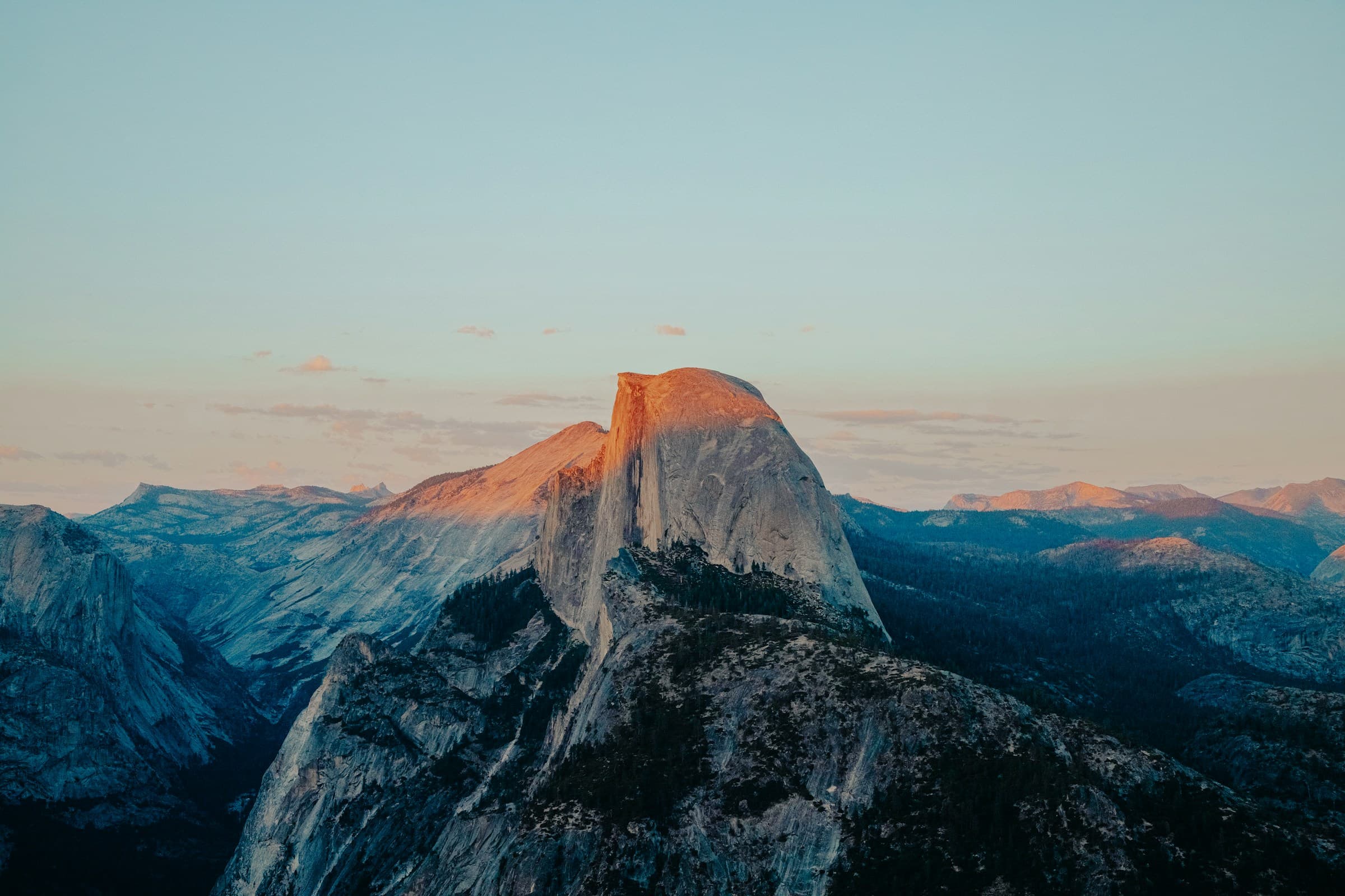
Half Dome is the iconic granite dome rising 1,440 m above Yosemite Valley — its sheared northwest face is one of the most recognized rock formations in the world. The hike to its summit is a roughly 24 km round-trip with about 1,460 m of elevation gain, traditionally completed in a single 10–14 hour day, finishing with the famous cable route up the dome's curved back.
The standard route climbs from Happy Isles via the Mist Trail, named for the spray that drenches the granite steps beside Vernal Fall. Past Nevada Fall the trail eases through Little Yosemite Valley before rising again across glacial slabs to Sub-Dome — a steep, exposed staircase that feels like a warm-up for what comes next. Above it sits the cable route: roughly 120 m of fixed steel cables anchored to wooden footrests up the dome's smooth back, gaining the last ~130 m of elevation at slopes around 45°. Most hikers descend via the John Muir Trail, slightly longer than the Mist Trail but gentler in fading light.
Half Dome requires a permit, period. The cables are installed only from late May to mid-October (snow-dependent); outside that window the route requires technical climbing skills. Permits are issued by lottery — a preseason lottery in March covers most of the season; daily lotteries run two days ahead for cancellations. Without a permit you cannot legally ascend the cables, and rangers do check. Start early — ideally pre-dawn from the trailhead — to be off the cables before afternoon thunderstorms, which are common in July and August. Cables in rain are unsafe. Bring 4+ litres of water; the only reliable refill is at Little Yosemite Valley (filter required). The hike is non-technical but the cables are unmistakably exposed; many strong hikers turn around at Sub-Dome.
Where it goes
6 stops connecting Happy Isles trailhead to Half Dome summit. Click a marker for details.
Standard cable-route day hike
A 24 km round trip with the famous cable section in the final 130 m of climb. Permit required to ascend the sub-dome steps. Most hikers start pre-dawn from Happy Isles to be off the cables before afternoon thunderstorms.
- 1Excursion fromHappy Isles trailhead24 km24.0 km