Kilimanjaro (Machame Route)
Kilimanjaro National Park · Tanzania
The most popular ascent of Africa's highest peak — 7 days from rainforest to glaciated summit at 5,895 m, going up via Machame and descending Mweka.
- Distance
- 62 km
- Elevation gain
- 4,200 m
- Duration
- 7 days
- Type
- One way
What you’re getting into
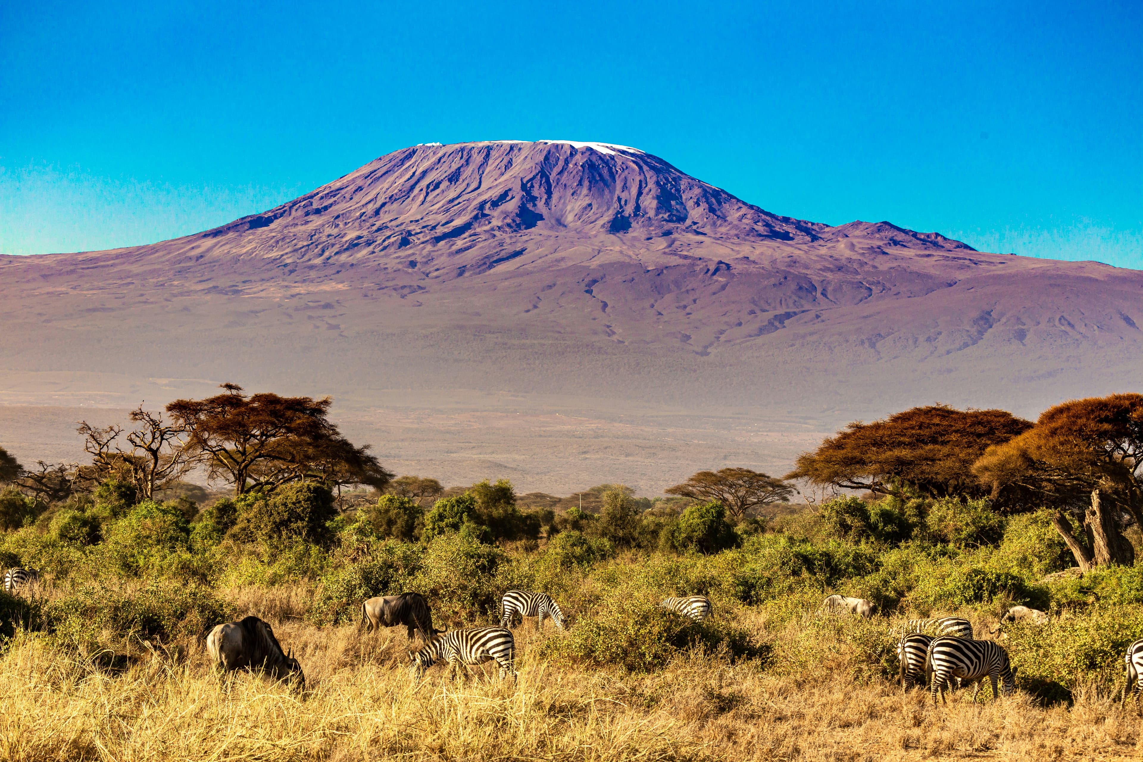
At 5,895 m, Uhuru Peak on Kilimanjaro is the highest point in Africa and the world's tallest free-standing mountain — a glaciated volcanic cone rising nearly 5 km from the Tanzanian plains. Machame, nicknamed the "Whiskey Route" (versus the easier "Coca-Cola" Marangu Route), is the most popular non-technical ascent: a 7-day, ~62 km traverse going up via Machame Gate and descending the opposite side via Mweka, with summit success rates commonly cited around 85% — the highest of any standard route on the mountain.
The trail climbs through five distinct ecological zones: cultivated foothills, montane rainforest dripping with epiphytes, heath and moorland of giant lobelias and senecios, alpine desert of volcanic gravel, and the Arctic-like summit plateau of glacier and ice. Day 3 traverses Lava Tower at 4,630 m before dropping back to Barranco — the classic "climb high, sleep low" for acclimatisation. The Day 4 Barranco Wall is the trail's only scrambly section, a hands-and-knees haul up the cliffs above camp. Summit night begins around midnight at Barafu (4,673 m): six to seven hours of switchbacks in headlamp darkness to Stella Point at 5,756 m, then a final 45-minute walk along the crater rim to Uhuru just after sunrise. Most groups descend the same day to Mweka Camp at 3,100 m — over 2,800 m of descent in one push.
Climbing Kilimanjaro is mandatory-guided through the Kilimanjaro National Park Authority (KINAPA): no independent climbers. You'll travel with a licensed lead guide, assistant guides, a cook, and a team of porters. Trekking seasons are January–March (cold, fewer crowds, occasional snow on summit) and June–October (dry, busier). April–May and November are the long and short rains and not recommended. Altitude is the defining challenge: take seven days at minimum, hydrate aggressively, and consider acetazolamide under medical advice. Total package costs through reputable operators typically run $2,000–4,000 per person; cheaper outfitters often pay porters poorly — KPAP-certified operators are the ethical choice.
Where it goes
10 stops connecting Machame Gate to Mweka Gate. Click a marker for details.
Standard 7-day Machame ascent
Day 3 climbs to Lava Tower (4,630 m) before descending to Barranco — the classic "climb high, sleep low" acclimatisation move. Day 6 is summit night: depart Barafu around midnight, reach Uhuru at sunrise, descend ~2,800 m to Mweka Camp the same day. Adding an 8th day at Karanga improves summit odds.
- 1Machame GateMachame Camp11 km11.0 km
- 2Machame CampShira Camp 25 km16.0 km
- 3Shira Camp 2Barranco Camp10 km26.0 km
- 4Barranco CampKaranga Camp5 km31.0 km
- 5Karanga CampBarafu Camp4 km35.0 km
- 6Barafu CampMweka Camp17 km52.0 km
- 7Mweka CampMweka Gate10 km62.0 km