Camino Francés
Pyrenees → Galicia · France / Spain
The most-walked Camino de Santiago route — 780 km from the French Pyrenees to Santiago, traditionally finished in 30–35 days.
- Distance
- 780 km
- Elevation gain
- 14,000 m
- Duration
- 31 days
- Type
- One way
What you’re getting into
The Camino Francés is the most traveled of the Camino de Santiago routes, running roughly 780 km from Saint-Jean-Pied-de-Port in the French Pyrenees to Santiago de Compostela in Galicia. Most pilgrims finish it in 30–35 days, averaging around 25 km per day.
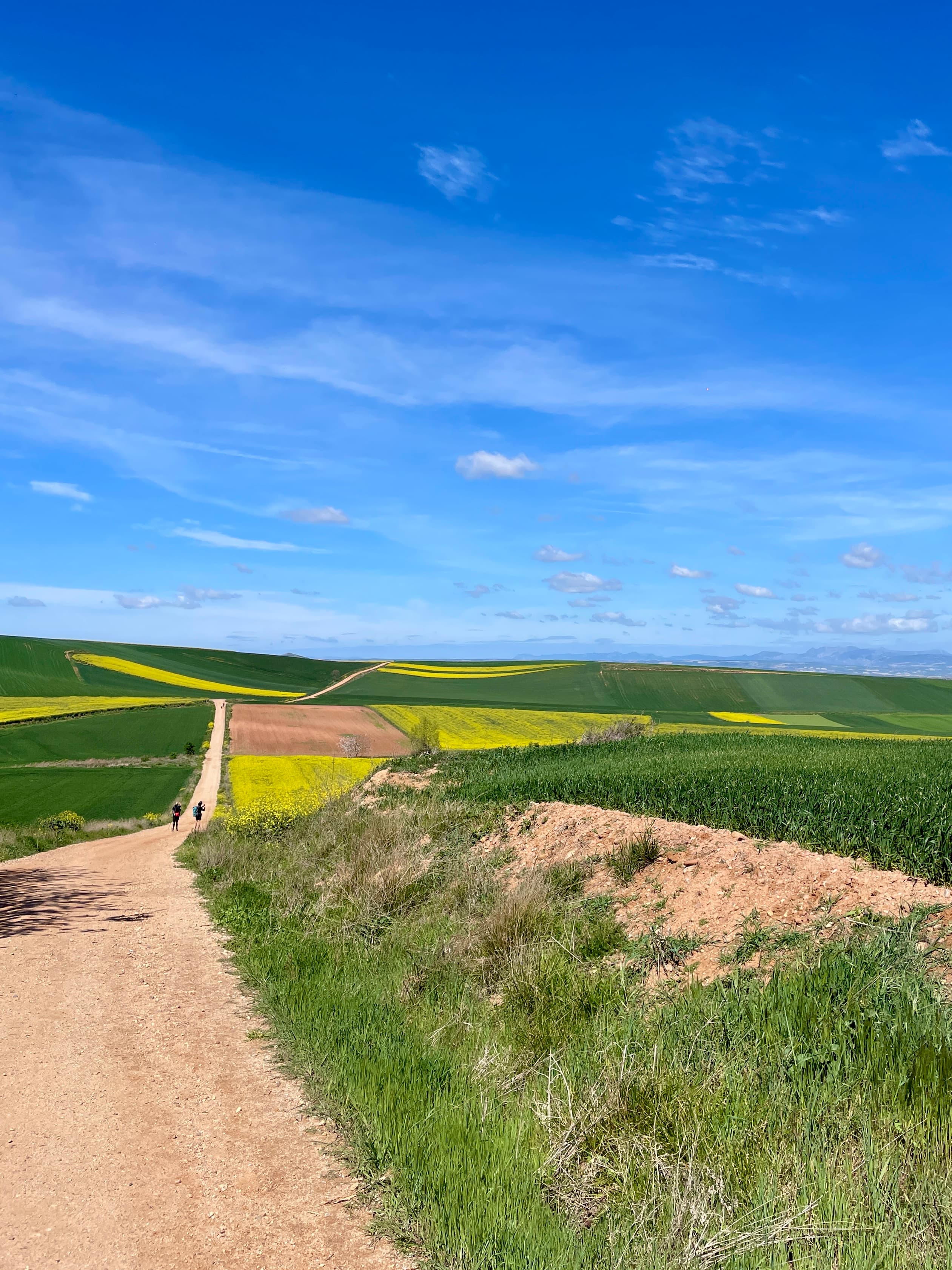
The route opens with its hardest day — a steep climb over the Pyrenees to Roncesvalles — before settling into the rolling Navarrese countryside through Pamplona. From there it crosses La Rioja's vineyards via Logroño, then the long, exposed Meseta: a high, treeless plateau between Burgos and León that many pilgrims describe as the mental heart of the walk. After León, the terrain rises again into the mountains of O Cebreiro, where you cross into Galicia's green, misty hills for the final stretch into Santiago and the cathedral that holds the relics of St. James.
Beyond the distance, the Camino is defined by its rhythm: early starts, shared albergues, simple menús del peregrino, and the steady company of fellow pilgrims from every corner of the world walking the same path. Infrastructure is excellent — waymarked yellow arrows, frequent villages, and affordable albergues — which makes it accessible without diminishing the challenge.
Where it goes
32 stops connecting Saint-Jean-Pied-de-Port to Santiago de Compostela. Click a marker for details.
Suggested 31-day route
Common guidebook split. Average ~25 km/day with one long day into León.
- 1Saint-Jean-Pied-de-PortRoncesvalles25.7 km25.7 km
- 2RoncesvallesZubiri21.5 km47.2 km
- 3ZubiriPamplona20.4 km67.6 km
- 4PamplonaPuente la Reina24 km91.6 km
- 5Puente la ReinaEstella / Lizarra22 km113.6 km
- 6Estella / LizarraTorres del Río29 km142.6 km
- 7Torres del RíoLogroño20 km162.6 km
- 8LogroñoNájera29.6 km192.2 km
- 9NájeraSanto Domingo de la Calzada21 km213.2 km
- 10Santo Domingo de la CalzadaBelorado22.7 km235.9 km
- 11BeloradoAgés27.4 km263.3 km
- 12AgésBurgos23 km286.3 km
- 13BurgosHontanas31.1 km317.4 km
- 14HontanasBoadilla del Camino28.5 km345.9 km
- 15Boadilla del CaminoCarrión de los Condes24.6 km370.5 km
- 16Carrión de los CondesTerradillos de los Templarios26.6 km397.1 km
- 17Terradillos de los TemplariosEl Burgo Ranero30.6 km427.7 km
- 18El Burgo RaneroLeón37.1 km464.8 km
- 19LeónSan Martín del Camino25.9 km490.7 km
- 20San Martín del CaminoAstorga24.2 km514.9 km
- 21AstorgaFoncebadón25.9 km540.8 km
- 22FoncebadónPonferrada27.3 km568.1 km
- 23PonferradaVillafranca del Bierzo24.1 km592.2 km
- 24Villafranca del BierzoO Cebreiro28.4 km620.6 km
- 25O CebreiroTriacastela21.1 km641.7 km
- 26TriacastelaSarria18.3 km660.0 km
- 27SarriaPortomarín22.4 km682.4 km
- 28PortomarínPalas de Rei25 km707.4 km
- 29Palas de ReiArzúa28.8 km736.2 km
- 30ArzúaO Pedrouzo19.1 km755.3 km
- 31O PedrouzoSantiago de Compostela20 km775.3 km
Detours and weather alternatives
Branches off the main route. Some are scenic, some are safer in bad conditions, some skip a long stretch.
Valcarlos route
Saint-Jean-Pied-de-PortRoncesvalles
The lower-valley alternative to Route Napoleon over the Pyrenees on Day 1. Follows the Nive valley through Arnéguy and Valcarlos before climbing more gradually to Roncesvalles. Less elevation, less exposure — the recommended option in fog, snow, or strong wind, when Napoleon may be officially closed.
- Distance:
- 24 km
- Elevation gain:
- 850 m
Samos detour
TriacastelaSarria
A scenic monastic detour out of Triacastela: drops down through the Sarria valley to the Benedictine monastery of San Xulián de Samos (one of the oldest in the West) before rejoining the main route at Sarria. Adds ~6 km but is widely considered worth the extra walking.
- Distance:
- 24.5 km
- Elevation gain:
- 400 m